Final Report on UN ESCAP Training Courses on Applications of Remote Sensing and GIS Technology for Natural Resources and Disaster Management
(Group A & Group B)
Institute of Remote Sensing Applications,
Chinese Academy of Sciences(IRSA, CAS)
August 2011
1 Brief Introduction to the training
“UN ESCAP Training Courses on Applications of Remote Sensing and GIS Technology for Natural Resources and Disaster Management----Group A: Geo-data Modeling about Earth Surface Phenomena & Group B: Development of GIS Technologies, Softwares and Applications”, sponsored by United Nations Economic and Social Council for Asia Pacific (UN ESCAP), organized by Institute of Remote Sensing Applications, Chinese Academy of Science (IRSA) (Department of Research and Development, National Remote Sensing Center of China (NRSCC), Ministry of Science and Technology (MOST), P. R. China), and co-organized by Chinese National Committee for Remote Sensing (CNCRS), The Associate on Environment Remote Sensing of China (AERSC) and Committee of Environmental Information System and Remote Sensing,Chinese Society for Environmental Sciences (CEIR-CSES), were held from April 11 till July 15, 2011 at IRSA for totally 12 DPRK participants from DPRK State Academy of Sciences. The guidance and support of UN ESCAP, the well preparation of lecturers and experts, the hard-work of training secretariat, and the collaboration of DPRK participants contributed to the success of the training workshop.
2 Opening Ceremonies
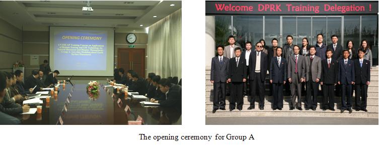
2.1 Group A
The opening ceremony of “Group A: Geo-data Modeling about Earth Surface Phenomena” was held on April 11 at IRSA. Professor Li Jiahong (Director of Global Earth Observation Department, National Remote Sensing Center of China), Professor Wu Guoxiang (Former director of Space Application Department of UN ESCAP), Dr. Guo Zhifeng (Representative of UN SPIDER), Professor Gu Xingfa (Director of IRSA), Associate Professor Zhou Xiang (Chief of Scientific and Technical Department of IRSA) and teacher representatives attended the ceremony and expressed congratulations and welcome to 6 DPRK participants who were PAK Chol Min, PAK Song Kwang, RI Mun Hui, RI Song Ryol, HAN Yong Han and JO Song Il.
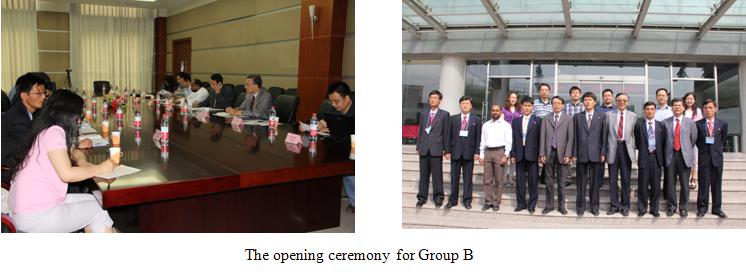
2.2 Group B
The opening ceremony for “Group B: Development of GIS Technologies, Softwares and Applications” was held on May 30 at IRSA. Professor Li Jiahong (Director of Global Earth Observation Department, National Remote Sensing Center of China), Professor Wu Guoxiang (Former director of Space Application Department of UN ESCAP), Dr. Shirish Ravan(Beijing office head of UN SPIDER), Professor Gu Xingfa (Director of IRSA), Prof. Xiao Qing (Chief of the Science Support Center, IRSA) and teacher representatives attended the ceremony and gave speeches and expressed congratulations. Six participants of Group B from DPRK, YANGYong Ho, KIM Kyong Jin, PAK Chol Rim, SONKwang Sik, CHOEYong Min, KIMPyong Chol were warmly welcome!
3 Training Courses
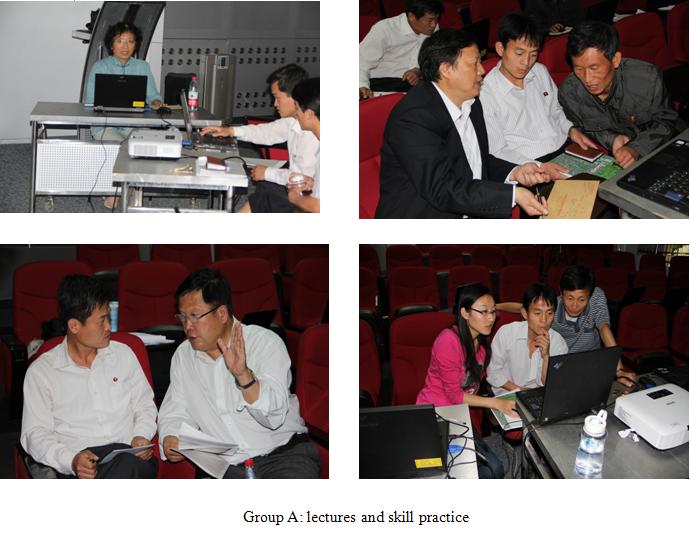
3.1 Group A
According to the training curricula, 28 lectures and 31 skill practice courses regarding 8 fields in “Fundamentals of Remote Sensing and GIS”, “Land Cover Management”, “Natural Disaster Modeling”, “Coastal Parameter Monitoring”, “Monitoring of Aerosol Particles Using Ground Based Remote Sensing”, “Greenhouse Gases Remote Sensing”, “Information Systems for Infrastructure Development Planning”, “Potential Fishing Zone(PFZ) Forecasting” were given by experts and assistants including Academician Tong Qingxi, Prof. Wang Jinnian, Prof. Chen Liangfu, Prof. Cui Weihong, Prof. Li Zhengqiang, Prof. Liu Yalan, Prof. Liu Qinhuo, Prof. Niu Zheng, Prof. Qiao Yanyou, Prof. Wang Changyao, Prof. Zhou Yi, associate professor Wang Xiao, Dr. Yan Nana, from Institute of Remote Sensing Applications, Chinese Academy of Sciences; Prof. Chen Shirong, National Disaster Release Center of China, Ministry of Civil Affairs of the People’s Republic of China; Prof. Li Zengyuan, Institute of Forest Resources Information Techniques, Chinese Academy of Forestry; Prof. Li Jiren, China Institute of Water Resources and Hydropower Research; Prof. Liu Yuguang, Ocean University of China; Prof. Liu Yu, Institute of Remote Sensing and GIS, Peking University; Prof. Shan Xinjian, China Earthquake Administration; Prof. Zhang Peng, National Satellite meteorological Center, China Meteorological Administration; Professor Zou Bin, National Satellite Ocean Application Service, State Oceanic Administration; associate professor Tang Jiakui, Yantai Institute of Coastal Zone Research, Chinese Academy of Sciences; and associate professor Tang Yixian, Center for Earth Observation and Digital Earth, Chinese Academy of Sciences.
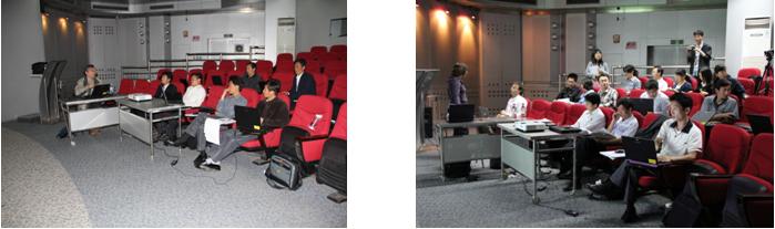
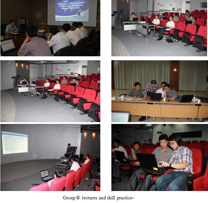
3.2 Group B
According to the training curricula, 30 lectures and 28 skill practice courses regarding 7 fields in “Fundamentals of Geographical Information System”, “Introduction on GIS Software”, “Application of GIS and Other Technologies”, “Algorithm for Express of Spatial Features and Calculating Their Properties”, “Programming and Algorithm(1)”, “Programming and Algorithm(2)”, “ITS GIS Customized Software Package Development” were given by experts and assitants, including Prof. Wang Jinnian, Prof. Yang Chongjun, Prof. Qiao Yanyou, Prof. Liu Yalan, Prof. Xiao Qing, associate professor Zhou Xiang, associate professor Ren Yingchao, from Institute of Remote Sensing Applications, Chinese Academy of Sciences; Prof. Chen Bin, Prof. Du Shihong, Prof. Liu Yu, Prof. Limei, from Institute of Remote Sensing and GIS, Peking University; Prof. Li Jiren, from China Institute of Water Resources and Hydropower Research; and technician Tain Feng, from Beijing SuperMap Software Co., Ltd., etc.
In the meantime, Prof. Liu Chuang, from Institute of Remote Sensing Applications, Chinese Academy of Sciences, was invited to give lectures on RS & GIS internationl organizations for DPRK participants of Group A and Group B, which well extended’ their knowledge on International cooperation. Participants’ interacting with lectures made the training results very fruitful.
4 Technical Visits
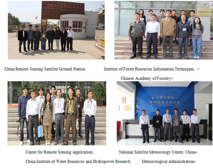
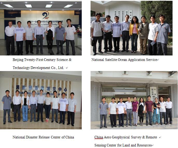
4.1 Group A
10 technical tours including visits to China Remote Sensing Satellite Ground Station;Institute of Forest Resources Information Techniques, Chinese Academy of Forestry;Center for Remote Sensing Application, China Institute of Water Resources and Hydropower Research;National Satellite Meteorology Center, China Meoteorological Administration;Beijing Twenty-First Century Science &Technology Development Co., Ltd.;National Satellite Ocean Application Service;National Disaster Release Center of China;China Aero Geophysical Survey & Remote Sensing Center for Land and Resources; Institute of Remote Sensing Applications, Chinese Academy of Science; Institute of Geographic Sciences and Natural Resources Research, Chinese Academy of Sciences were arranged for training participants of Group A.

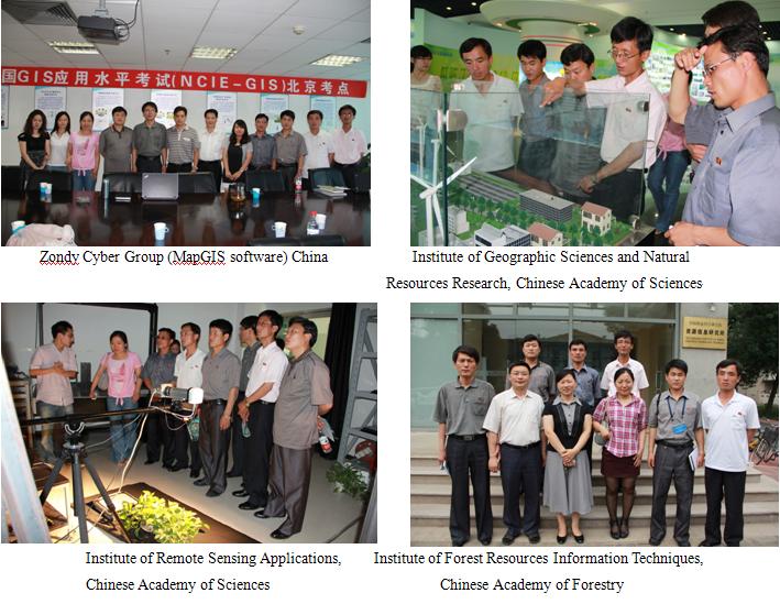
4.2 Group B
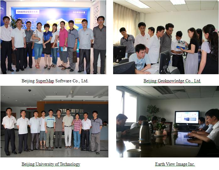
9 technical tours including visits to Zondy Cyber Group (MapGIS software) China; Institute of Geographic Sciences and Natural Resources Research, Chinese Academy of Sciences; Institute of Remote Sensing Applications, Chinese Academy of Sciences; Institute of Forest Resources Information Techniques, Chinese Academy of Forestry; Beijing SuperMap Software Co., Ltd.; EarthView Image Inc.; National Geomatics Center of China; Beijing Geoknowledge Co., Ltd.; and Beijing University of Technology were arranged for training participants of Group B.
The participants were impressed by softwares developed and satellite imageries processed by the reception units, enjoyed in the communications with those units and got books and journals of their highly research achievements.
5 Closing Ceremonies
5.1 Group A
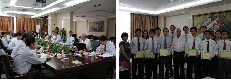
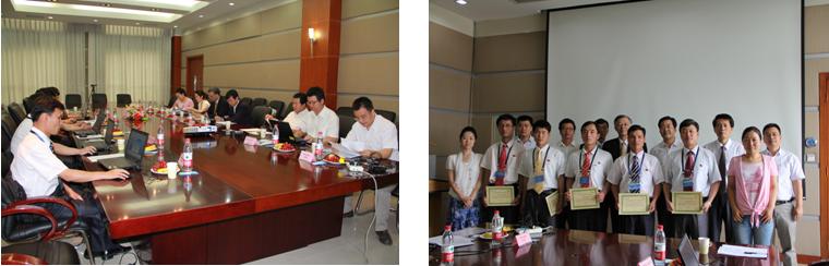
We are honored to have Mr. Seung Hun Jung (Project Expert of UN ESCAP), Prof. Wu Guoxiang (Former director of Space Application Department of UN ESCAP), academician Tong Qingxi (IRSA) and Prof. Wang Jinnian (Deputy Director of IRSA-CAS) to attend our Closing Ceremonies for Group A. Training participants were great impressed by the invited presentation given by Academician Tong Qingxi, titled “The Frontier and Trend of RS for Earth Observation”. The DPRK participants in Group A all completed their final reports and got course completion certificates.
5.2 Group B
We are also honored to have Mr. Seung Hun Jung (Project Expert of UN ESCAP), Prof. Wu Guoxiang (Former director of Space Application Department of UN ESCAP), Professor Zhao Qianjun (Deputy Director of IRSA-CAS) and Professor Qiao Yanyou (IRSA-CAS) to attend our Closing Ceremonies for Group B. Prof. Qiao Yanyou gave invited presentation titled “GIS Applications in Forest Pest Information Management and Decision Support ”. The DPRK participants in Group B all completed their final summary papers or project proposals and were awarded course completion certificates.
6 Training Facilities and Supporting
6.1 Training Materials
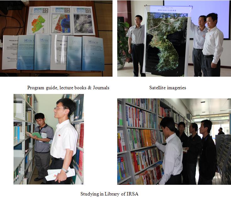
Training materials including lecture PPT, program guide, satellite imageries, journals books and softwares were well prepared for DPRK participants. After official contact, we helped the training participants to get satellite imageries they wanted from National Disaster Release Center of China, get Journal of Remote Sensing, as well as get softwares on trial.
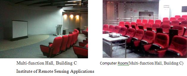
6.2 Classroom and Technical Supporting
In order to support the training courses and DPRK participants use in class and in the rest days, we arranged 6 laptop computers for each of them to take with during the 7 weeks of training. We also arranged class rooms inside our institute with wireless network for their convenience. Since the training courses were held in the hot summer in Beijing, we also bought participants a water dispenser to drink cool water.
6.3 Accommodation
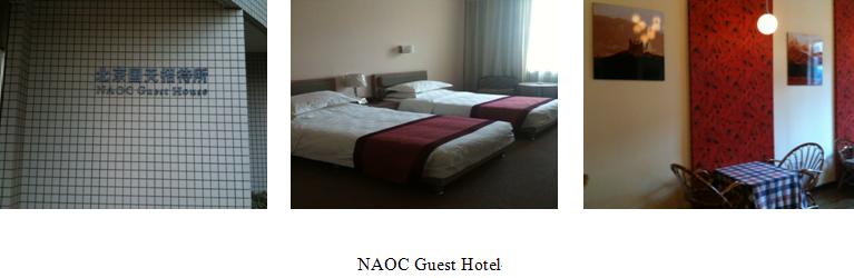
NAOC Guest Hotel, which is inside our Science & Technology Garden, was arranged as the reception hotel for two groups of participants during the whole training period, for their convenience just to walk to our institute and classrooms.
6.4 Meals
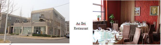
In order to make DPRK participants feel at home, we prepared both Chinese food and Korean folk meals for them.
6.5 Local Transportation
Participants were provided with local transportations for technical visits and activities organized under the training courses in Beijing.
6.6 Insurance
We bought personal accident insurance for 12 DPRK training participants.
6.7 Interpreter
All lecturers and assistants gave lectures in English. And our training secretariat provided English-Korean-Chinese interpretation for all DPRK participants during the whole training period.
7 Extracurricular Activities
7.1 Sightseeing
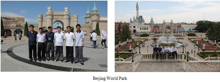
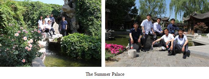
In order to enrich DPRK participants’ spare time, we accompanied them for sightseeing around Beijing city including Beijing World Park, the Imperial Palace, and the Summer Palace.
7.2 Pingpong Match
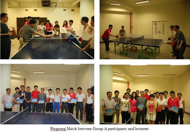
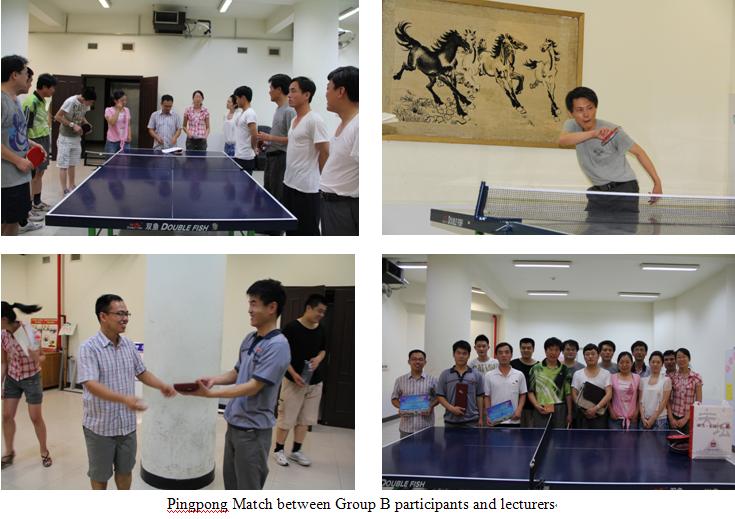
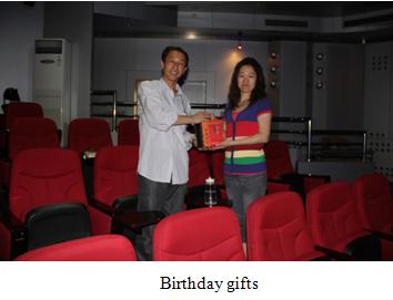
Besides trainning courses, we arranged activities such as Pingpong match to enhance understanding and friendship between DPRK participants and Chinese teachers. And the participants also received memory gifts during their birthdays.
8 Training Experience & Advice
8.1 The training project was well prepared, which led to the success of its complementation. Leaders of Institute of Remote Sensing Applications (IRSA) paid great attention to this training program. Prof. Wang Jinnian, deputy director of IRSA, coordinated and led the training secretariat in person to guarantee everything run smoothly.
8.2 Add more skill practices courses in the future, which will enhance training results.
8.3 Add more technical tours to RS & GIS application units and make participants have better practical experience in their topic areas.
8.4 We’d like to provide three further study and research opportunities to the training participants or their colleagues in the future, which have been discussed during this training courses closing ceremony.
8.4.1 Apply to Chinese Academy of Sciences for master or doctor degree.
8.4.2 Apply to Institute of Remote Sensing Applications for PhD program.
8.4.3 Apply to Institute of Remote Sensing Applications for RS & GIS project cooperation.
8.5 It’s our great pleasure to provide satisfactory service for DPRK participants to study and stay during their training courses. We’ll cherish their suggestions and feedback and make our training in the future more successful.
9 Cooperation Intentions
We believe that the success of this training course will have an active role in promoting the cooperation in RS and GIS technology and its applications between China and Democratic People’s Republic of Korea (DPRK), improving the ability of natural resources applications and disaster management, and promoting regional economic and social development and prosperity.
It’s also our honor to cooperate with UN ESCAP. Thanks for your great support. We’d like to contribute to the prosperity of Asia and the Pacific. So we wish a further cooperation with UN ESCAP in the future. Any suggestion and advice on improving our training programs are welcome.